Skied right off the map again. Those tours are the best. It’s particularly funny considering that the headwall that caught my eye to ski here in the first place, the nominal objective itself, was just precisely off the map, but only by a bit. Granted, this is a map I printed many years ago, because that’s how it is around here, doing more with less, for the sheer beauty of it, curating my experience, even just subconsciously. It’s all about joyful engagement, sloppy and loose with a sense of humor and humility, but in a dialed, efficient manner, with accuracy, if not precision, and maybe a bit of flair at times, aspiring to an insouciant competence, a feral adeptness, with the assured presence of a wild thing. If I can fake all that, I’ll have it made.
I liked the idea of revisiting the Three-Pin Ramp on rondo gear, and ever since I was struck by that steep slabby watermark-streaked headwall with the cascades coming down, above the old trail past little Cutthroat Lake backpacking one time, and thought how cool it would be to ski that. And then when I skied upcanyon from home into lower Rockbound Valley at the beginning of the month, I was eyeing it again across the valley. I have a sweet tooth for steep little headwalls and keep an eye out for likely candidates. I even considered trying to ski it by driving around to the west side, but when I started looking at the map I realized it actually looked pretty doable from Bayview, without the hours of driving. And I noted that the layout of 4Q Lakes basin presented the opportunity to try and finesse it, skin-free shuffling to avoid a couple extra full skin transitions for the rolling return to the Rubicon River crossing. The glaciers plucked and gouged the bedrock granite on a broad scale, carving big round bottomed drainages, knocking the sharp edges off, and on refrozen neve you can glide for miles, if you can negotiate the terrain cruxes. I love a good route-finding challenge, to finesse the landscape, and increase my range and ease of motion, like a boss.
I showed up at the trail head with more daylight than I intended, could have been fifteen minutes earlier when first light blushed and still not needed a headlamp, which I do carry regardless, but try hard to not use. But I was also hoping to keep my day under twelve hours, so maybe I’m right on time, Aloha time. There were already a few ski vehicles there, and a couple gals who appeared to be wrestling with overnight packs. I jammed the car in next to a van that had a note “gone skiing till thurs”. It being Wednesday, I felt free to park extra close, since that’s all the room I had.
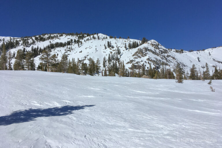
It froze good last night, with clear skies for max radiational cooling, light flow out of east, low twenties, except for a slight midmountain inversion. And it barely thawed at all with the east wind blowing the day before, so good residual freeze. The corn cycle still seems likely to be incomplete anywhere but south facing, lower elevation, or local spots where the old wintery snow had blown off, ridgetops, windward spurs, convexities and such. The Waterstreaked Headwall faces east. I tried to consider other more conducive objectives in the neighborhood. I was just going to have to go see, figure it out as it unfolds, just point ‘em in the right direction and start striding.
I had been getting a little twinge in the front of my left shoulder the last few days, since my last big tour, though it didn’t hurt till the day after. Pain in a new place, how fun! Aging is chock full of fresh exciting challenges. Mortality does have it’s drawbacks, but it’s still the best deal in town. Lately my body has been pushing through such things though. What even is pain? Its connection with actual damage seems indirect at times, prone to histrionics, like some sort of autoimmune thing, with odd comings and goings and referrals. Last week my left knee was inflamed after sweet pow skiing one day, but then felt better after even more crusty skiing in Rockbound a few days later? What’s that about? Sleep on it funny? Electrolyte imbalance? Acquired environmental sensitivity? Solar flares? idk
The thinned forest above the campground was rutted and refrozen hard, but I resisted putting my ski crampons on, wanting to keep my light fluid rhythm and momentum. Also, expedient false-laziness. I didn’t feel like stopping. I knew I’d need the harscheisen to gain the ridgetop above me, on the steeper, less protected slopes below the pass, but they would be a hindrance on the half-mile bench between, so.
Moving smartly, I focused on my ski and pole placements, trying not to over-pole, just lightly touching for balance and cadence, except where needed, letting my legs do the work, easing my body into the journey. The day’s first sun penetrated the forest in golden shafts, to the happy chatter of chickadees. I follow the summer trail over through the overlook outcrops, bathing in the long light. I half expect there to be snow campers at the lake but the basin is free of human noises, or it was till I got there.
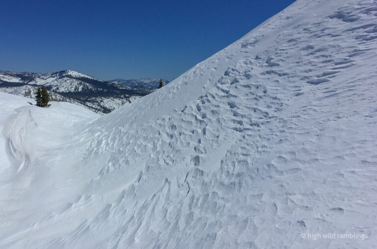
I work over onto the shady steep old growth above the lake and finally affix my ski crampons. They clang like cow bells underfoot as I work up the hard snow, self-consciously intruding on the still morning air within this little basin. Their purchase is positive, though, and I relish picking my way up the steep complicated surface, lost in the little picture, foreground focused ‘plan and execute’ mode, linking smooth moves up the mountain, at one with my element. And with each little foot placement decision, I try to conservatively aim for the whole day. I pull up short of the summit, forgoing the normally obligatory view with the savings in mind, where I remove my ski encumberments and start my long glide into the wilderness, my back to civilization.
Bending over to click my bindings, a little twinge in my lumbar reminded me of my extracurricular shoveling yesterday, around my burn pile, maybe not such good timing before a marathon day (especially since I didn’t end up getting around to burning it till the after snow was melted). The traverse is frozen and fast. I zip past an igloo someone built on the ridgetop. No present occupants. Airbnb glampsite? I trace our familiar traverse, following snow patches weaving in and out of knolls, the convenient ridge conveying me westward. I stop and shoulder my skis, to follow the boot pack from last week. Only instead of the interminable low cresting traverse left at the top, I just dropped down toward my goal, side slipping through the steeper forest, working left down to the little lake, shooting out onto the ice, to skate across the smooth hard surface, around a bit of open water at the constriction, then across to the base of the far slope, just beneath the PCT.
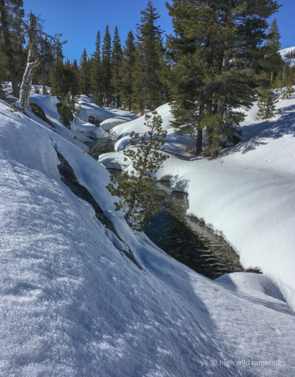
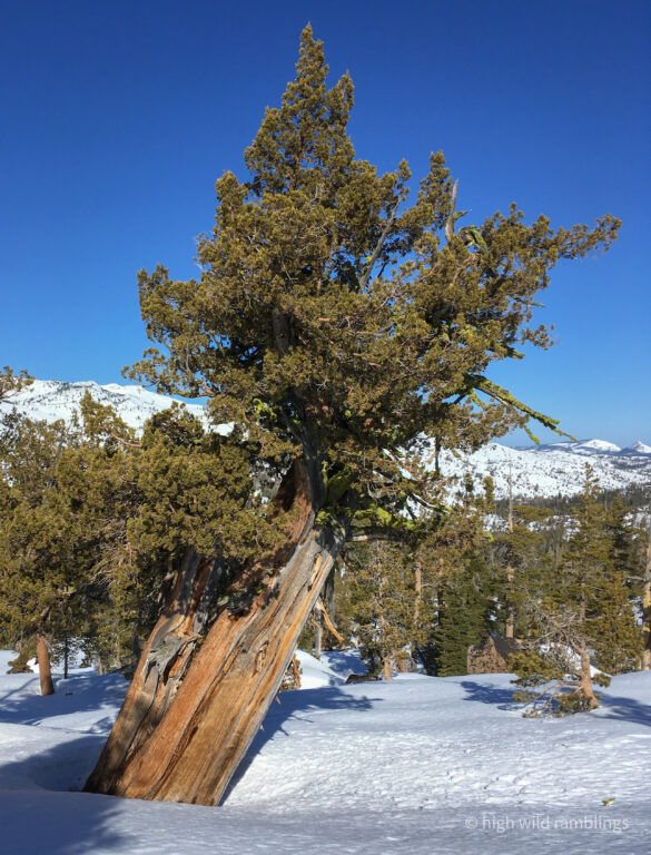
Here, I do a little skooting move, skinning up a quick couple hundred feet to get a leg up on a gliding traverse across the thick forested flats leading down to the Rubicon River. This move reminds me of watching blue jays hop branch to branch up into trees, to then glide further off into the forest, quickly gaining the vertical height to enable gliding a substantial horizontal distance. It works out well for me, allowing me to keep my heels locked gliding for the intricate sidehill into the canyon. Down to the final opening above the river where I can link skritchy turns smoothly down into the deep embrace of Rockbound Canyon. I love this little run through the junipers and glacial erratics into the heart of big rugged lonely Desolation.

A word about the use of the term ‘river’. To call the Rubicon a river here feels like a stretch, having grown up near the mouth of the Hudson River where it’s a mile across. This here is just a creek, really. Granted the Rubicon River was named downstream forty-some odd miles where it joins the middle fork of the American River, where it is decidedly more river-like, with a formidable flow seasonally. Even up here near the headwaters, big midwinter rain on snow events can make our demure little river here into a raging, deeply incised torrent, impassible for miles for much of the ensuing winter. I suppose too, that Lake Tahoe is not exactly representative of your average lake now, either. Our language seems geographically deficient. And this place tends to defy conventional descriptors. We need more folks who talk terrain.
The Rubicon name is evocative, presumedly a reference to the river in Italy that was a key boundary in Roman times, the crossing of which amounted to an act of war for Caesar’s troops, hence the classic, drama enhancing phrase, the ‘crossing of the Rubicon’ in reference to an irreversibly committing act. Apparently Rubicon is such an iconic name, the miners wanted to maximize its utility, because they used it a lot.
We have the dramatic granite bound Rubicon River here, which flows nearly to Georgetown, where it’s big and swift and more riverlike, and where they were first mining in the gold rush. And we have Rubicon springs on the riverbanks midway between there and here, which is the site of an old mineral spring resort from a hundred and fifty years ago (or thousands for that matter), and current site of jeeper jamborees, downriver here a few miles, along the Rubicon Trail, the famous OHV route that crosses the Sierra above the springs, which follows an ancient native trade route, and for which a model of Jeep is named.
Not to be confused with the pedestrian Rubicon trail, across the Pacific Crest continental hydrologic divide most of ten miles away on the west shore of Tahoe, which follows the rocky banks from Emerald Bay to Rubicon Point, with it’s hundred foot tall cliff dives dropping right into Tahoe. Or ‘Rubicon Trail’ could, for that matter, readily refer to the summer user trail that goes up to popular Rubicon Peak, nearby on the west shore, which is a popular backcountry ski peak with a distinctive summit crag, lending it a pileated profile (not to mention little Rubicon Lake which is more of a pond really, at the very head of Meeks Canyon, well upstream on the backside of the peak, but not in the Rubicon River drainage). So much Rubicon. So little clarity.
But what’s really interesting, which I just learned this spring, (in a Park archeologist’s graduate dissertation on the subject) is that the local native Washoe names for the Rubicon River is T’agi wotta, which means ‘knife’ river, and the prominent mineral spring located on it is T’ági p’agá’aw. And the Washoe name for Rubicon Peak is T’agiya, Knife Peak being an appropriate name, given its blade shaped summit crag.
So, huh? Common names between these distinct places in both languages? Is there some other inscrutable connection between the places, one of spirit, or some other resonance? Why dismiss connections as random serendipity just because we can’t explain them? I am fond of such connections, taking them of indicative of something special going on that we can’t quite discern. I take comfort in the sense of a bigger picture than our brains can fathom, embracing the uncertainty and ambiguity. This is what I’m after out here, to engage that uncertainty, to see what it might suggest.
The Rubicon River and Rubicon Peak, T’agi wotta and T’agiya, are like opposing poles in my own personal world, the two special places I visit most in my surroundings, seasonally with the conditions, summers on the river and winters on the peak, more or less monthly, for decades now. The Washoe word Isgeʔes, which translates as “moving about”, is how they refer to their former, pre-Goldrush lifestyle, moving up and down the mountains seasonally, summers in Tahoe and winters in the valley below, as they did for thousands of years.
To have lived here so long, the natives would have had to have been true masters of their ways, Nature’s finest students and practitioners. Forget ten thousand hours, try ten thousand years. Long, engaged exposure on whatever scale, facilitates an emergent knowledge and intelligence, through accumulated pattern recognition specific to the varying conditions in a place. We front-load that with the attentive time we spend engaging our environs on different fronts. We go out to meet ourselves, and see how we fit in this greater Life spinning on all around us. We do the work building that base. We dance to see how the rhythms move us and feel how the songs resonating deep in our chest reverberate out into the world, joining the joyful ruckus of the dawn chorus.
I feel like my language, and how I use it to think about this world, is tied to this landscape, and my personal long-term relations with it, how I learn to adeptly move through it, amongst my fellow denizens. For those with eyes to see, the learning is innate. I can only dream of what that level of deep, deep connection, that can only form over thousands of years of actually living off this land, could possibly feel like, to truly be a full fledged part of all this living going on, not just interlopers and profiteers.
But even at my scale, having spent my adult life here, rambling far afield from my home, I can envision my layers of tracks forming webs across this landscape I dwell in, forking and merging like mycelial networks, my emergent synaptic map. I am of this place. Its waters flow in my veins, my course follows it’s ways.
Besides it just feels cool saying it, Rubicon River. Now to find a crossing. I aim for right above where the creek I’m following comes in, and headed upstream. The river was looking kind of low and narrow, but the banks were deep and there was no snow bridge in sight. But just upstream I spotted what looked like a bit of snow suspended across the water. I eyed it carefully and decided to see how it felt. I sideslipped down to the river’s edge. It looked shallow here, maybe a only a foot. The snow was still quite firm. I sidled out onto the little tongue of snow perched on a bulge that I envisioned containing a buried boulder, the mesmerizing waters flowing beneath me. I stemmed across, avoiding the weakest, saggy looking portion of the bridge, settling my weight on the far side, before stepping smartly across, and then side-stepping up the steep bank on the other side. I smiled to myself, that I have crossed my Rubicon, now I am committed. Until I decide to turn around anyway, though I’m not so sure that particular snowbridge will survive today’s sun beating. I sit in the shade and put my skins on, thrilled with my progress. Already I’m in as deep here, as I’ve been all season, and it’s only 9:30.
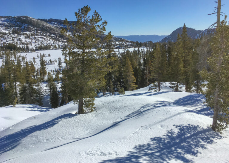
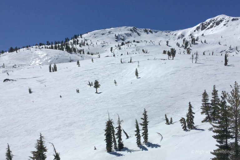
I follow along up the opposite bank of the river, keeping an eye out for a better crossing, before heading up into the jumbled terrain above the river, following a meadow to melting-out ponds and cross the creek coming down from another lake basin above, then pick my way up through steep convoluted forest along the outlet to the most easterly of the oddly named 4Q lakes (maybe their shape? or a facetious estimate of their meager volume?), making for an open slope I spied through the trees. I take out my map and stare at it, and look around at the terrain around me, and stare at the map some more, not so sure of just how they relate. At first I think I need to get further right, then I think left. So I just keep going up the easier way, trying to avoid going any higher than I need to, trying to follow what looks like a drainage without getting mired down in it.
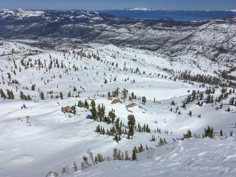
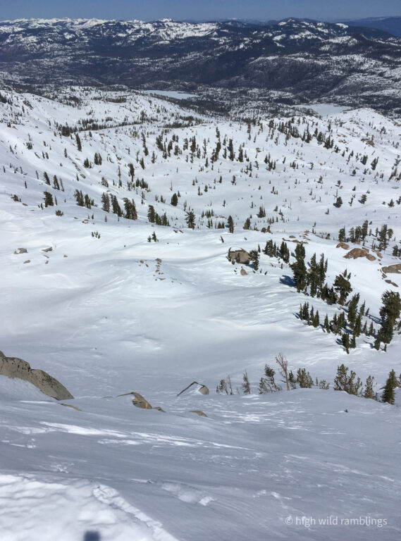
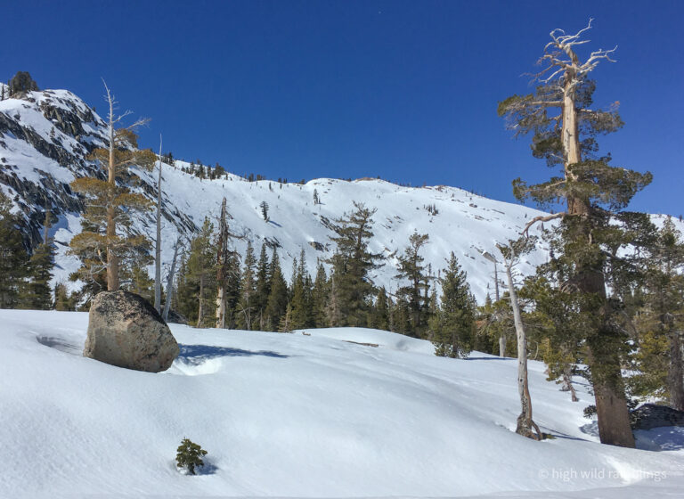
Eventually, I come out on a little lake. I am tempted to strip skins, as I was planning to sometime soon, but I see the convoluted terrain appears to continue subtly climbing beyond, so I refrain for now and keep on shuffling, following the vague inlet up through steep benchy terrain hidden in the forest, one of those spots where I just cant see an apparent way, but I follow up on faith, trying to think like water in reverse, following a bit of a weakness, to find an unseen but improbably easy way through. This little glacier scoured lake basin drains in both directions. It’s hard to read the terrain, all jumbled and shrouded in chaotic forest, only visible close at hand, without an obvious grade, trying to put my position together from glimpses of distant ridges through the boughs, trying to read the lay of the land. Cross-country travel over snow is mostly about geometry and physics, where in the summer it’s often more about botany.
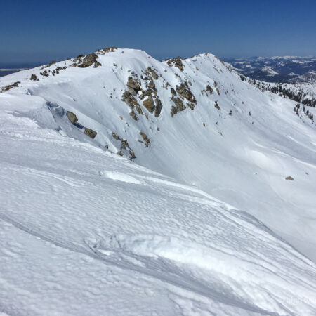
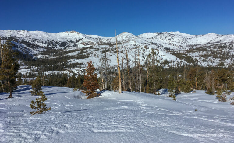
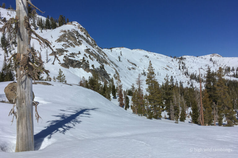
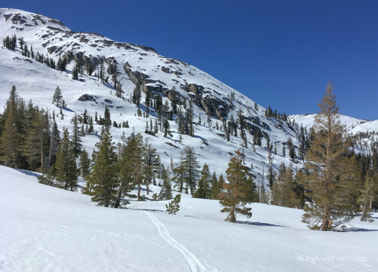
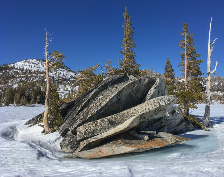
I gain a low rise and see another little lake stretch out before me, and the terrain beyond leading down towards the junction with the creek from further upcanyon. Now I can finally take the drag rags off my bases and glide like a properly evolved snow mountaineer. I skate out across the lake, traversing wide left around the gentle meadows below. The terrain ahead is more cliffy and I have my doubts about being able to take a high traverse line on the way out to avoid a skin. Eventually, I get drawn down into the steep little ravine, milking it as far as I can, till I come to where the creek that flows down out of the upper basin joins. Here I reskin and follow on up the creek, cresting a bench to find myself in the high basin beneath the Crystal Crest, within the maw of the stone dragon, the ranks of big sharp facets closing around me, which sounds dark and ominous except it’s the friendly Sierra so the sun is blazing and the sky is impossibly blue and the cliffs look like Hollywood Styrofoam, smooth and clean, decorated in bright neon lichens and draped in water streaks in shades of satiny ochre and umber, where seemingly nothing bad could ever happen.
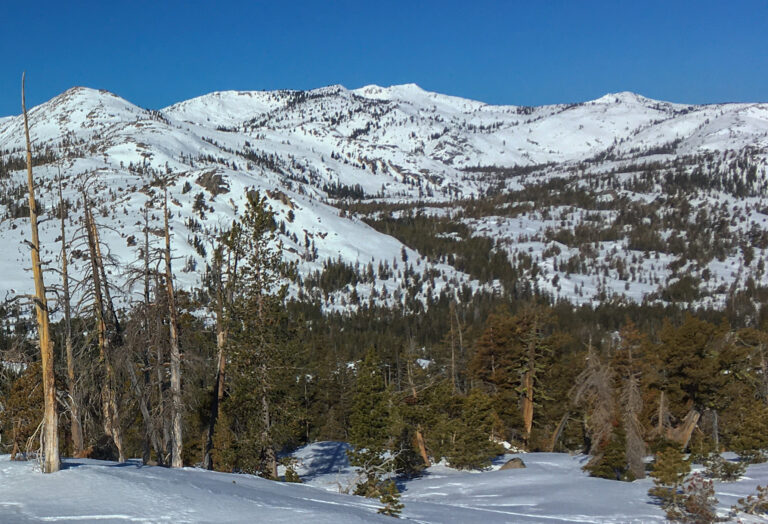
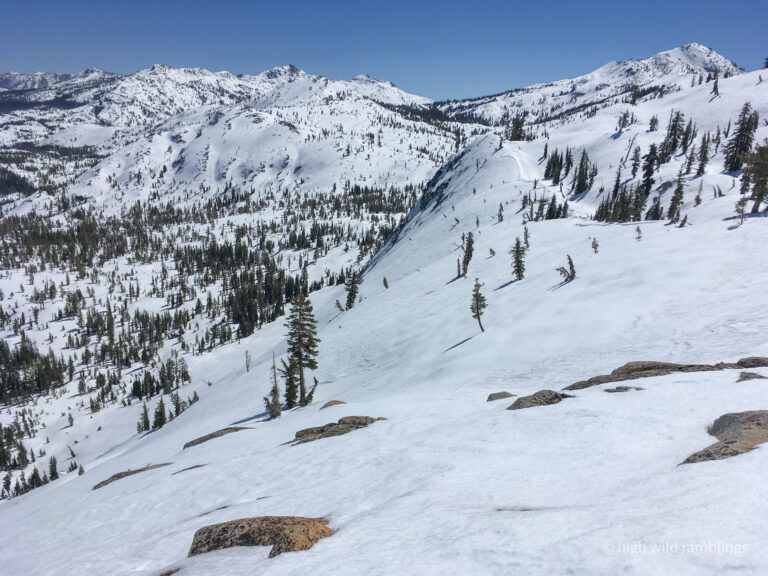
Now I could see the face I wanted to ski up close, and endwise to display the pitch. Those steep slabs I remember walking beneath so many summers ago, that I had looked at so longingly as some unskiable expression of an ideal, now look more tame all covered in smooth, brightly glistening corn snow, looking mouth-wateringly delicious. I pick out landmarks on the knob at the top of the fall line I deem most inviting, just beyond where the cascade itself presumedly flows, knowing that when I actually get there from above, I won’t be able to see the terrain below at all. The figuring is part of the fun of such a tour, getting my head into it, and vice versa, translating the symbolic ink and pixel mapping, and all my imaginary scheming, onto the real physical rock and snow world, with the gravity turned on.
The slopes above little Cutthroat Lake look quite inviting too, wrapping around more south easterly towards corniness, and being a little taller and more intricate than the fall-line I had eyed around the corner. I skied the edge of this steep slope on my three pins when I first skied here from home about eight years ago. But I wish to hold true to my vision here now, and explore the terra incognito in the remote basin, NE below my favored point on the Crystal Crest at the top of the Three-pin Ramp, as I took to calling it when I first skied it, and the striking Water Streaked Slabs beside the cascade above the remote old summer trail. This is how language comes about, naming things so we can discuss and strategize, organizing the world before us, giving us something to stick our data to, for further colation. Language is a tool of intelligence, for analyzing our options, and charting our course. It’s not just for lying and bragging.
It is spooky to picture the snowfields resting on the sheer granite slabs beneath with so few anchors, but I know many of our favorite steep ski lines are similarly situated on bare slabs, and the good old bomber Sierra snowpack stays put. The usual glide cracks we see on such slopes open up slowly over time in the late spring, after most folks have hung up their skis and switched to climbing or boating or riding or whatever, but they rarely fail all at once, except during big heat wave meltout events, when you wouldn’t want to be out skiing anyway. That’s the beauty of focusing on skiing where the good snow is, it’s also generally the safer snow too. And if there’s no good skiing, then that’s what I’ll do. No skiing. I’ll just do something else. We are only guests here. It behooves us to be gracious.
The day is heating up, and I link patches of shade where I can. I looked at my gps track from a few years ago when a buddy and I skied to the river and back, on a day so crusty we devised a long tour with a total minimum of actual descent skiing. It took us three and a half hours to get back to the trailhead from the river that day. So, if I figure I want to be back out by seven, since it gets dark at seven thirty, I should be back at the river by 3:30, and if I leave an hour and a half to ski from the Crystal Crest to there, I should be skiing by 2. Or by a less refined method, if I just give myself twelve hours to hike, and split my day in half, since it’s an ‘out and back’ tour, I should be skiing by 1ish. Right now its 11:15 and I only have thirteen hundred feet to climb, which shouldn’t take more than an hour, so I have lots of time. (In actuality, it took me only fifty minutes to summit, but two hours to ski back to the river. That’s why I build a cushion in. And bring a headlamp, which I take pride in hardly ever using. Our judgement and discipline is all we really have to keep us safe. That is the key to our freedom.)
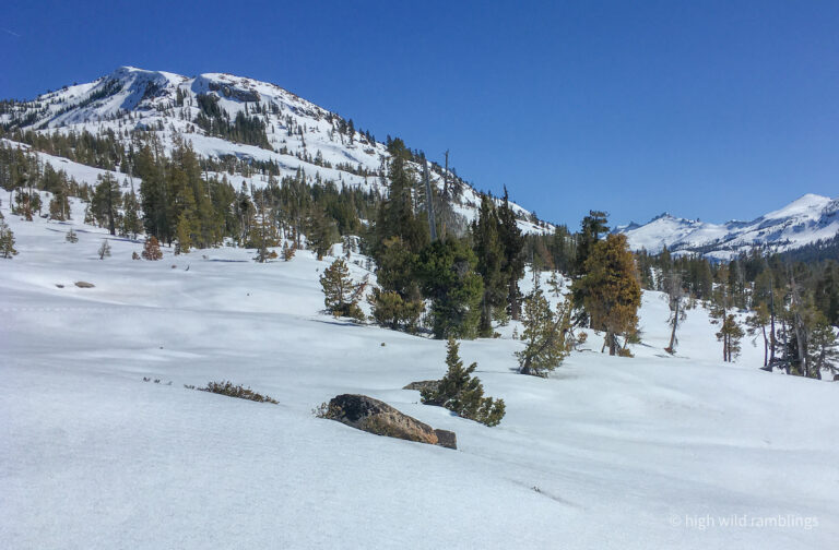
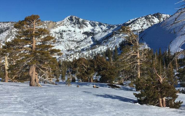
But meantime the sun is beating down and the snow feels like it’s ripening underfoot, and I can feel the corn clock ticking, as conditions slowly start to progress towards slop, I can hear the footsteps. I gain the Three-pin Ramp, shortcutting a bit over the edge of the steep slope above the lake, and I follow the gentle treed ramp up, marveling at the rugged Crystal Crest looming above me, at my immediate left hand. I see no other passable way through this steep terrain all around me and yet I am rising to meet it, as if via some special treatment from gravity.
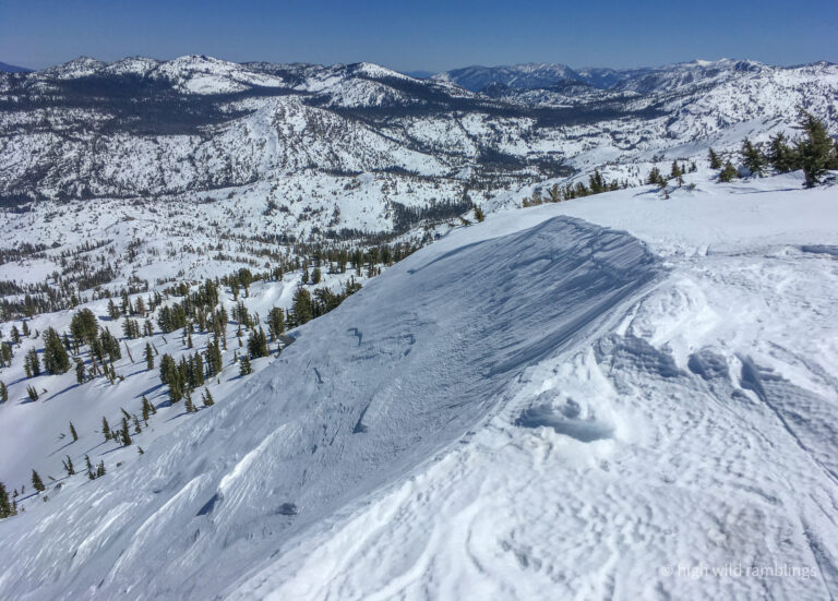
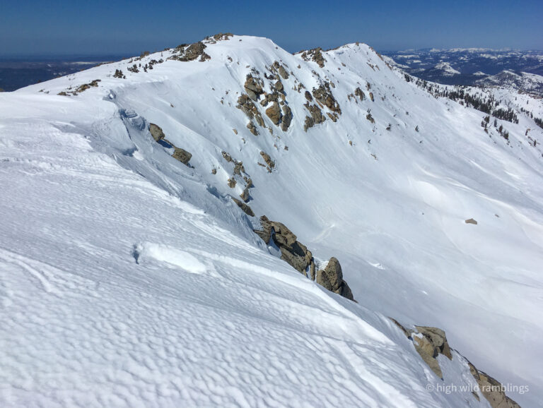
The approach to the summit just gets gentler and gentler, with only the expected false summit, while the cliffy and corniced terrain around me rose to eye level, until finally, inexorably I arrived on the crest. The broad west slope of the Sierra rolled right over the other side, off into the hazy oblivion of the great Central Valley nine thousand feet below, between my tips.
Before I even dropped my pack, I sidled over to the edge to peer down at my intended ski terrain below to the northeast. There was a shady little pocket bowl with a mosaic of different snow textures, a smooth chalky-looking swathe directly below me felt nice under my pole as I whacked it. The dimpled surface below it looked firmer but still chalky and not refrozen. The entrance was moderate, and then where it rolled over out of sight, the snow field branched off in either direction and reappeared at a reasonable interval below. The sun was shining in along the surface, at too low an angle to soften things much but illuminating and cheerful anyway. It was direct and only moderately steep, exposed above a steeper convexity below, which looked likely to go through but was admittedly an unknown. I figured it looked worth venturing down to see anyway. I could turn around and boot back up if I didn’t like it, in theory anyway, one I’ve rarely had to put into practice.
Looking eye-level north down the crest to the named peak proper, it was more cliff than not, and the ways through looked discontinuous and dubious. I could see just beyond the next little saddle north that there was a continuous looking line that went through, with a little bit better angle to the sun, but some suspicious bulges and stretch marks, possible coverage issues? hmm. Tough call. I like wintery wind board. I like the idea of skiing the fall line from the top, rather than sniveling down the ridge to a more benchy, less continuous line. Or I could ease back down the sunny side to ski the more SE face above Cutthroat Lake that I had looked at on the approach. I recall last time I was here, which was also the first time, on my three pin fishscale skis eight years ago, I felt a little slight to my mountain pride, by skiing back down the gentle way I came instead of skiing the steeper more direct fall line from the top, the more pure expression of our mountain aesthetic (though I did get onto the steep face above the little lake, and make some rad turns further down). Hmm, wonder what I’ll do, I muse with detachment, as if watching someone else making such a portentous decision, alone in all this wildness. For now, I have my summit chores to do.
I sat, not even thinking about it, and ate my Italian sausage sando, taking in the expansive views of my favorite spots, novely viewed now from the back side. I’ve completely covered the depth of our ski domain, three ranges deep, clear to the far side, where I see it all anew. I could sit all day, but I got an appointment, with a beer at the trail head before dark. And my nominal steep corny headwall objective, unseen a couple of benches below, is likely already over-ripe. I remember when I skied here from home, feeling quite isolated and exposed so far from civilization, on my flimsy old freeheel three-pin fishscale gear, enervated and anxious to get moving again. I feel more relaxed now. This is an easier tour, shorter, on more sturdy and effective gear, with better conditions. I linger for over half an hour before I rally myself back into motion. Wouldn’t want to stiffen up.
Gravity, being what it is, draws me down. I drop over the edge, abruptly skittering, edging noisily, ineffectually, that dimpled snow harder than I thought, and as I chatter across trying to gain control, my lumbar twinges sharply. Thankfully, it’s not too steep, and I manage to scrub the momentum and regain control and stand there poised on just a couple skinny edges on the firm slope, jacked. Now what? The pitch divides around an outcrop below me, and the more dimpled snow continues down the more southerly right side of the hump, but the shadier side looks more like wind buffed wintery snow, through a little constriction. I snap a couple shaky turns, tentatively feeling my back out, to maneuver into a position where I can see down the next level. The snow is windboard, with a rough texture, but it’s supportive and carve-able, and I am able to make solid jump turns through the little constriction and down along the edge of the slope below, milking a patch of blown-in wintery looking snow out onto the bench.
When I peer back up at the slope, I am surprised to see that the dimpled snow I balked on, is actually shining glare in the sun. The lighting from above sandbagged me. I misread it. It has a mat wintery surface patina, but the dimples are through to the old icy firm layer beneath, which is what shines in the sun, and what I lost my edge on. But I reacted well, stopping and sussing the situation, and executing a methodical path, not just pointing them and trying to ride it out like the stunt skiers do at the circus. That’s not how I got this far. I guess all the crappy conditions I regularly ski on approaches around here, are my training for these blind headwall moments. For example, the refrozen mank I will need contend with this evening, on my final steep forested two grand descent above the trailhead. I’m reminded of my old motto, to ski the conditions, not my jones.
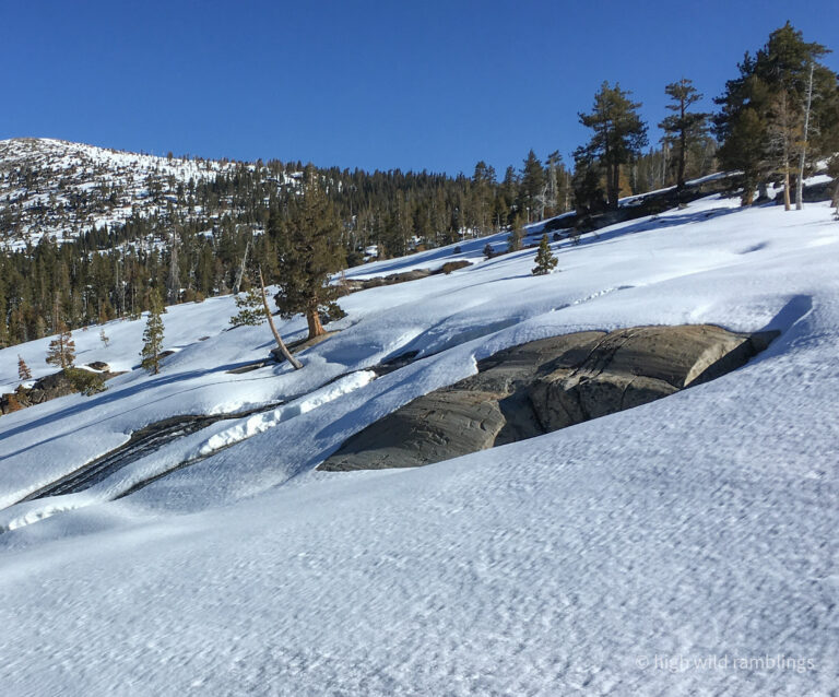
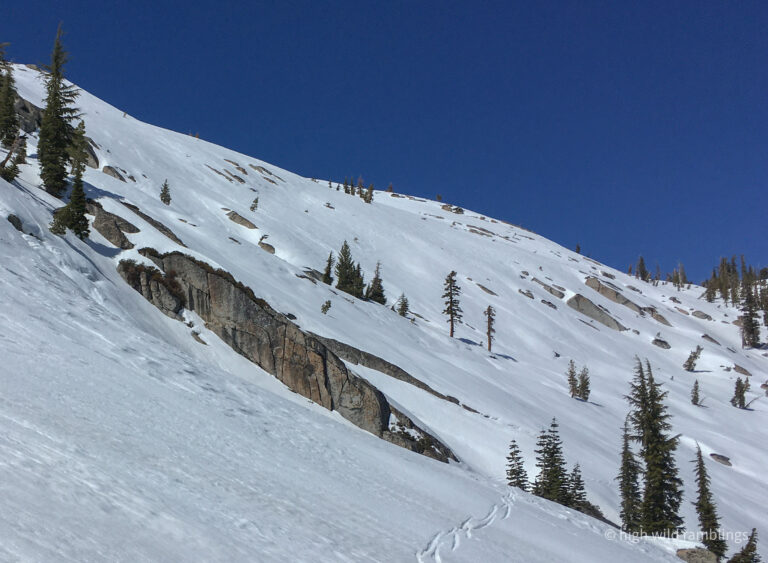
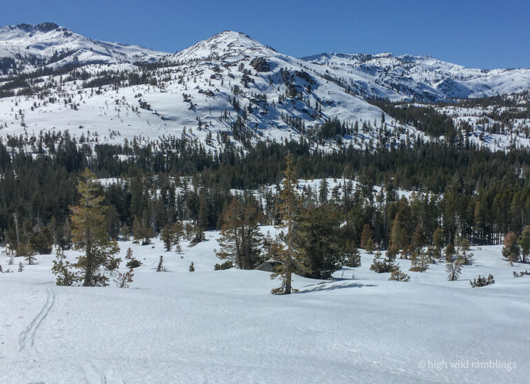
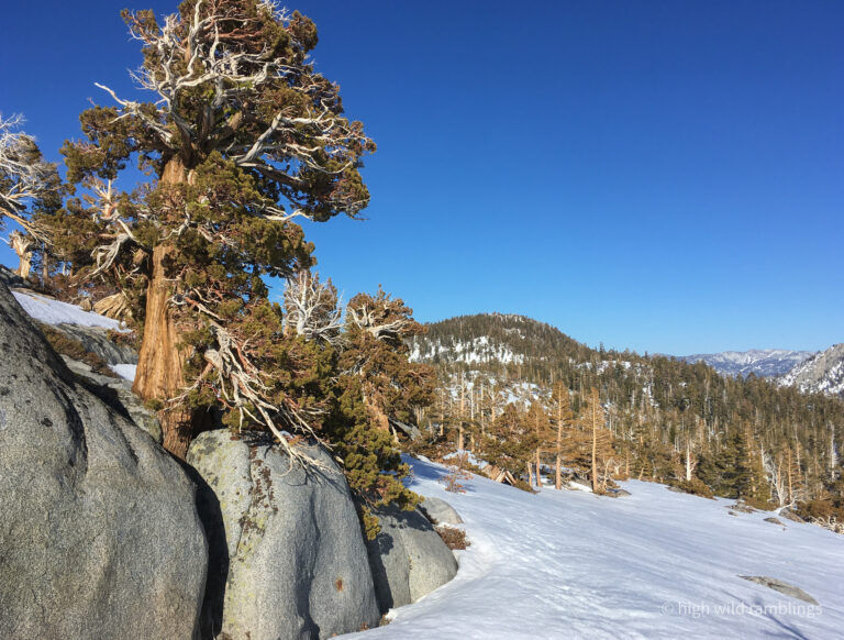
Here, where it’s lower angle, it’s crustier still, and I traverse out right looking for a rib to wrap around onto a sunnier exposure. I could still ski the more southerly face above the lake, which I eyed on the way in. It might well be better quality, but I am still clinging to my image of the slabby water-streaked falls above the trail. I can see over to where I think the top of it should be, but there is a deep trough and berm in the terrain between me and it, left behind by some headstrong glacier. This is cool alpine country, wide open, scrubbed naked granite, ground down in places, piled up in others, haphazard and raw, not abiding the usual top-down patterns of water eroded terrain.
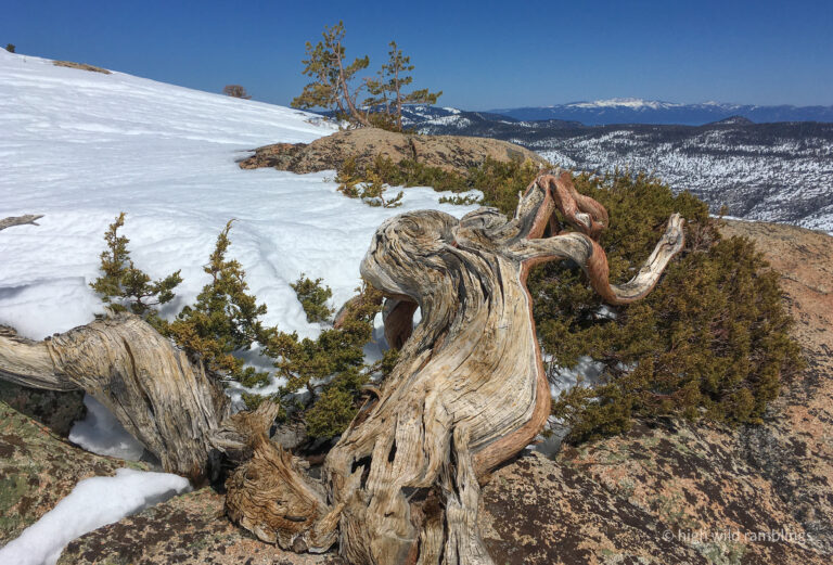
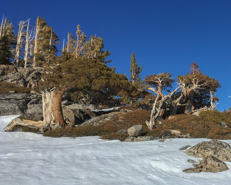
I recall finding lush alpine gardens here in the summertime, backpacking ten or fifteen years ago, deep clear freestone channels of snowmelt winding through dense beds of heathers and other cushion plants, matted atop the talus, spangled with spiky pink blossoms, and little drooping white cockleshells. Also, the showy, long petaled Lewisia, that grows nowhere in the world but here in this part of the Sierra, in discrete patches below perennial snow fields, above tree line. This is also where I first identified Kalmia, alpine bog heather, which is not nearly so rare, but still seldom seen, except in these exquisite little niches. These watercourse gardens are ‘just so’, with an improbably lush greenness, right through the long dry summer, in this sunbaked bare granitic alpine landscape.
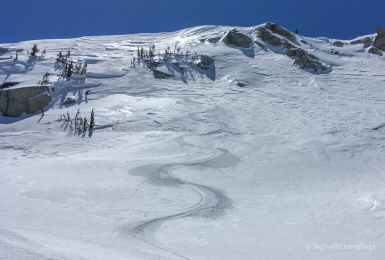
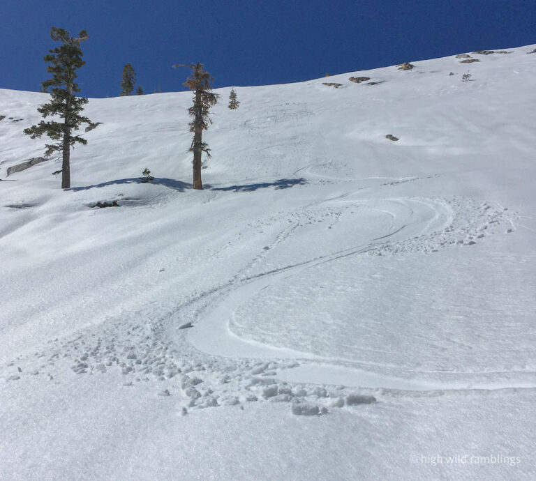
I cut back in on the slope, traversing left across the steep pitch, doing what skis do so well, making easy ground of difficult, wrapping way around cleanly, and onto the knob above the water-streaked slab headwall, with the distinctive bare spot I had identified as a landmark from below. I sidestep up onto it, completing that sparking connection between thought and actuality. The convex slope beyond rolls away out of sight, the way I like it. I step right to it, linking turns on the plastic corn snow down through the rocks, rolling onto the steep broad slope, spraying icy hominy kernels across the surface, rushing with me, joining in the headlong gravity dance. The pitch is not as steep as I had hoped, or as long, the fine snow quality likely contributing to those feelings, but I relish the rushing flow and the moments of gut-deep weightlessness. I glory in the sensation of flying down over this sheer polished water-streaked granite, doing the sacred water dance amidst snow cascades leaping and splashing. Mid-flight, I glance out at the landscape below, taking in my dramatic position, high above that precious stretch of canyon that I have explored from scratch, and gotten to know so well from home over the decades.
There I was, skiing that view, ripping it, down the steep corn face of my imaginings, gliding a few feet over the surface of these gorgeous arcing water-stained granite slabs, into the heart of the wildest most remote valley around. The snow was a little sloppy on the surface, the new snow not yet fully transformed, but solid underneath anyway. I could just make out rocks emerging on the steep roll below me, and nudged my headlong trajectory over to avoid them, skiing the steeps in a sort of controlled free fall.
I can feel the weightlessness in my gut in that key moment in the transition from one turn to the next, skis crossing the fall line, pointed straight down for an instant, free of the snow, airborne. The skis then re-engage in the new direction, biting into the snow surface till sufficient purchase is found to push off again, and turn back the other way, my oscillations defining the vector, tracing the wave form, chasing its mechanical ideal. That threshold of purchase varies in stages though, and when its really steep, you don’t get that same solid hold onto the slope before you initiate the next turn. You have to settle for less security, and just toss the turn from muscle memory while still sliding sideways downhill, as if. The momentum takes over, and you just kind of ride it, flowing like that cascade, applying a little English to keep it all aimed right. The forces gather and build, and as the pitch lessens, I carry more momentum to dump in the run out, opening up the radius of my turns, laying it all out.
That’s the idea anyway. Alas the reality wasn’t quite to that degree. Am I jaded? Or is the real significance of this ski line to be of a different sort, more part of my personal geography, connecting separate legs of my journeying through the years. It ties back to my home range, the places I travel under my own power directly from my house. From the tailwaters, my backyard granite-bound water haven in the summer months, this portion of the Crystal Crest stands framed by the intimate landscape like a distant alpine ideal, one I have visited on the longest ski tour I’ve done, from home. And now I have returned to that same spot in the Crystal Range, on descent gear, and skied the steep face with command, daytripping it from Emerald Bay, on another long ski tour.
And it occurs to me as I write this (6/16/21) that it closes a triangle I had first set up unknowingly, when I hiked one summer maybe twenty years ago, following the Pacific Crest off trail fifteen miles or so from Emerald Bay to home, along the suggestively continuous ridge top from above Eagle Lake, over Tallant and Crag and down Geeks ridge all the way home, putting together a few different off trail routes I had developed over many tours, into one long strenuous day. These three big cross country tours inform each other, leapfrogging skills and knowledge, and shifting relationships with my perceived limits over decades, fit together to form a geographic and temporal narrative, an exhaustively intricate off-trail dance through space/time. So many steps
Here now, it’s tempting to climb a quick 800’ up to the point above 4Qs to the south, to ski its east ridge to the river on my way home. I probably have time, if everything went smoothly, but I’m not inclined to push it. My back is still kind of whining at me, and so I feel like I should just point it homewards. It feels presumptuous to force it, and the practice of humility and restraint feels good.
After all, as I was trying to convince myself at the beginning of the season, restraint needs to be my new superpower, as my skiing matures, through necessity.
Practice means doing it now, even if you don’t need to, because it will make you stronger for when you do need it. The key being to practice smart, to minimize the impacts, on beleaguered joint tissue and such. I expect the couple grand descent off Maggie’s at the very end of this tour, will be refrozen hideous breakable crust, and the later I ski it, the more hideous it will be.
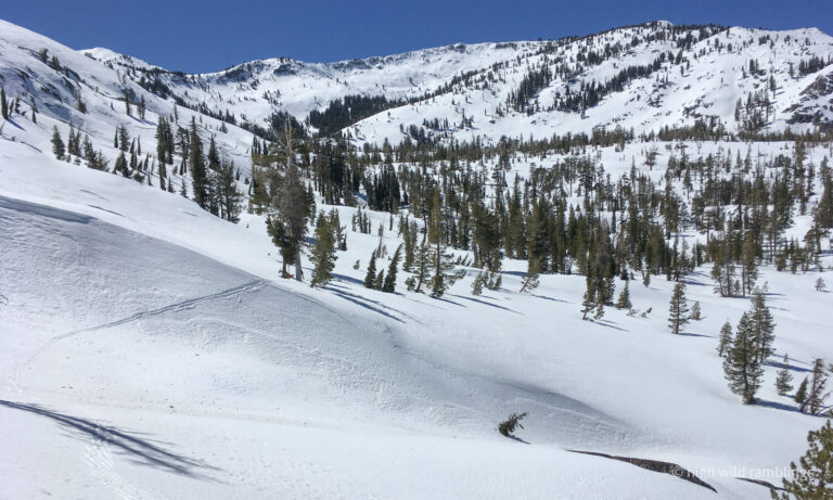
As the slope toes out, I want to traverse right, high enough to make it back around onto the bench below the little lake basin, but I also want to finish my run, so I gauge it, turn to turn, then traverse across beneath the slabs, scoping them from the vicinity of the summer trail with relish. I’m hoping to be able to traverse skin-free all the way to 4Qs and on down to the river crossing, figuring I will need to go free heel at some point. But for now I just keep moving, fighting it a bit to get on the bench, then skate traversing around the concavity of the valley, sidestepping up as I glide, tracing an arc across to the other side, aiming for a notch I spotted down low on the rib, above an outcropped knob, where I hope I can stay high enough to wrap into the 4Q basin at lake level to avoid needing to climb again. It looks doable on the map, though it seemed pretty craggy with patchy snow on the way in, from what little I could see, from the forest below.
I trace in and out of the subtle folds in the terrain, my skis like a sensitive divining tool, a seismograph needle responding to variations in the gravity field, gauging the glide properties of my skis on the varying snow surfaces. Skis are subtle, responsive devices that we learn to wield with our prehensile minds as if they were part of us, prosthetics wielded by the type of constant real-time micro-adjustments we already make with the balance muscles in our legs and core, continually all day, every day, without intention or awareness. We take for granted what a teetering balancing act simple two-legged locomotion is. So now let’s lash slippery planks to the balls of our feet and head for the snowfields! Worked fine for woolly mammoth hunting (maybe too well).
I make my way up through the notch by staying high, and round the corner onto the steepening canyon wall as I enter the 4Qs lake basin, still working to maintain my elevation, across slabs, on ledges, linking gaps, getting a little dynamic in spots, pointing it down narrow little sluices, hopping over rocks. The way it was, I got through fine and contoured in just below the lakes, where I popped the skis off quick to free the heels now that the trickiness was behind me, and continued shuffling more abley on the sun softened snow, across the first lake, then up along through the woods. At the limits of my purchase, weaving through the tree wells gets tedious without skins, having to really focus on each placement on subtly changing fall lines, minding the sun exposure to mitigate purchase issues on the shadier, firmer spots, constantly on the edge of slipping backwards, potentially explosively headlong backwards into a deep treewell or such. It takes a certain dexterity and focus level to find it efficient. Of all my partners, I only know one who does, and he’s here. Granted, these skinless freeheel shenanigans are aided by having scratched up old skis, preferably not too recently waxed. I seem to have the advantage over most folks on that count.
I managed to hold a tack through the forest, over the vague glacial ravaged divide, to where it finally drains down the other side through the last lake, towards the Rubicon, which I verified unequivocally by continuing until it dropped off and opened up, spilling out before me towards where my snow bridge river crossing is, or was anyway. Here I elected to have my second lunch and sat in the blessed shade and scarfed some more sando and enjoyed the exotic location, over seven hours into my day, still way out in the middle of nowhere. Most of the summer backpackers don’t even make it out this far. The exposure stirs me back into motion, that and trying to avoid letting my back stiffen up.
I lock my heels back down and tighten up my boots, for a nice few sets of corny turns on the open granite ramps, following about where I figured I came up, getting over at the base and then through the trees, crossing the side creek, linking little meadows and ponds, towards the sound of the rushing Rubicon. I didn’t recognize the spot I came to the river, or spy my tracks so I continued on upstream, diverting in extraneous flood channels and across through some jumbles, until I realized I was up on the other side, having crossed the river, where it was braided here beneath the snow, without even realizing it. That was easy. Talk about a low drama recrossing of my personal Rubicon.
We are near the headwaters here, up in the top of the drainage where it is still a wild flowing water course, above the last dam. The big burly steelhead trout used to spawn all the way from the Pacific Ocean up into Rockbound Valley here. The Washoe apparently had a yearly trek over the range from the east side on snowshoes to catch and smoke spawning salmon here on the west slope, on the American River just south of here, I suppose for a bit of variety, from the huge cutthroat trout they pulled from Tahoe.
About the time I realized I was across the river, I also realized I was following someone’s faint fresh tracks, and they weren’t mine. Three people on skinny skis, herringboning up along Velma Creek, but there were no signs of down tracks, including my own, since it was still firm when I descended. Wow. This is out there for nordic skiers. They appeared to have come along the river down Rockbound Canyon from Mosquito Pass, and maybe Echo Lakes or something, but where are they going? Probably snowcamping, and then back the way they came? All through routes in this direction get burly, a whole mountain’s worth of breakable crust on floppy boots and plastic toothpick skis, with big packs? That’s a long ways to kick turn. I’m intimidated enough skiing it in crappy snow on full descent gear with just a day pack. Regardless, they are covering a lot of ground. Impressive. Much props. It is a good reminder. There are all different kinds of badass mountaineers around. Our little wilderness here hides each other’s presence quite well, indulging each of us our own narratives of solitude.
I stopped in the shade and ate some more and put my skins on, for full immersion in the trudge back up the hill, the sodden rags on the bases make my skis into blunt instruments, inert but inexorable. Their tracks were already melting away, only intermittently visible, I was on a different tack now, skinning. I kept an eye out but saw nor heard any other skiers on my return. I drop my hands to my sides, and shuffle strait up the gentle slope, head down, oblivious. Periodically, I stop and look over my shoulder at where I just skied, in utter disbelief. It looks so far, already. Hardly seems real.
What even is reality? It’s not a thing. It’s a process, an ongoing rushing, or meandering, never the same river twice. The wave isn’t the wet stuff, it’s the up and down motion propagating out in radiating concentric arcs, interacting with whatever lies in it’s course. The idea of objects or given points in time are just that, ideas, abstractions, vain attempts at retroactive explication, artifacts of our feeble consciousness, our make-believe sense of self and narrative. We are but clots of flotsam in the chop. I just keep shuffling.
At the bank above Middle Velma Lake, I stop to take my skins off again, resigned to efficiency, taking my time, to make time. If it strikes you as odd that I came up to Middle Velma before Lower Velma, that’s because it should. Upper and Lower Velmas actually both flow east into Eagle Creek and on into Tahoe, while Middle Velma isn’t quite as between them as one might think looking at the map or hiking them in succesion, but rather is across the barely perceptible hydrologic divide there, and actually flows west into the Rubicon, headed to the Pacific. Gotta love such heavily glaciated terrain.
That subtle divide belies a significant inflection point in the environments throughout this part of the continent. The great west slope of the Sierra towering over the landscape for four hundred miles, wrings huge quantities of moisture out of onshore air masses moving up off the sea. And that water drains back in, carving down into the still uplifting west slope, watering some of the great conifer forests of the world, and the Central Valley, now one of the richest agricultural areas. But the Sierra Crest casts a long shadow, out into the vast arid landlocked Great Basin to the east. The divide can be stark. But here at the Velmas, not so much. This crest has also been a cultural divide, for many thousands of years, with the natural passes crossing the Sierra being crucial trading routes and nexus points of interaction between tribes living on either side, from a time when different peoples’ lifestyles were more directly tied to their differing environments, the landscape directly molding its inhabitants. Its all about the shifting processes of this roiling place, fluid dynamics rule.
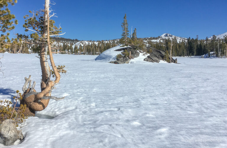
Without skins, my skis returned to their naturally nimble selves, and I kick and glide out across the broad lake, feeling it open up all around my periphery, zooming out to reveal me as a lone figure in a grand landscape.
I head to the cool little island, where a buddy and I chilled on an epic crust-with-a-view tour. I am leery of getting too close, but admire the exfoliating layers of granite, opening up like the pages of a book in the wind. I cross the lake, trying to figure the best place to exit, to milk the terrain without skins. This is a subtle zone, where the glaciers erased clear delineations of the topography, and I try to let my divining rod ski tips guide me. When its not quite level they let me know, by pulling the trapdoor. Suddenly sliding backwards out of control without warning, gets old after ten hours. The mountain can feel kind of like a bully sometimes.
I weave up through the lakes basin, taking advantage of the easy travel on the frozen surfaces, avoiding the juicy spots. Then tack up into the woods, linking patches, bound by the limits of my purchase, on up to the low divide between lake drainages, following along the route of the summer trail, milking my skinless status through the rolling terrain, gliding where I can. Then I finally reskin at the trail junction, for the final slog up to the pass. By six I am up on the shoulder a couple hundred feet below the summit, high enough to traverse around to the east side to drop to Tahoe, where I am parked. The snow is bad, a refrozen breakable surface crust forming on the softened muck beneath. I shamelessly sideslip along the summer trail, without even the pretense of actually trying to link turns, glad to be here as early as I am. Under twelve hours.
For quite a while I have been discreetly looking forward to the cold homebrew I have waiting for myself in a cooler at the trailhead. It’s generally considered poor form to mention the long-awaited beer until we are within a certain range. When I finally arrive, I drop my pack and pop a top, and sit on my cooler to remove my rank ski boots. Nothing like all-day full-body exhaustion to make a guy feel alive (even if it smells like something died in my boots).
Cheers to this exquisite Life we’ve been gifted. It feels good and right to go meet it where it dwells.